Weather in 2026 is forecast to remain extreme, with longer heatwaves, higher tides and more unusual heavy rain, posing risks to daily life and production.
Extreme weather intensifies over the past year
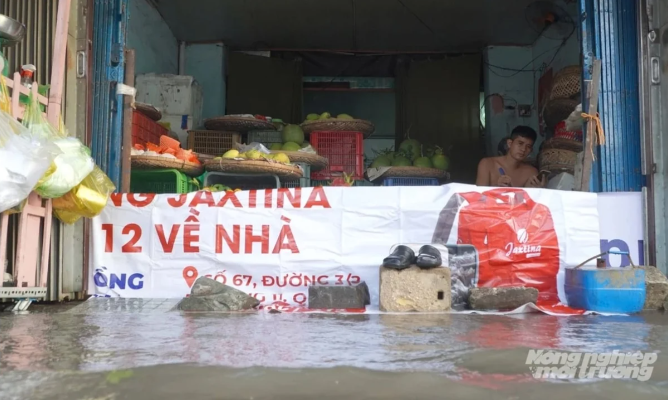
In early November 2025, when high tides coincided with heavy rain, the small house of Mrs. Nguyen Thi Sau in Phu Dinh ward, Ho Chi Minh City, was once again flooded. The old wooden cabinet had to be lifted onto bricks, while water rose above ankle level. “It floods every year, but this time the water came too fast”, she said.
The situation was not limited to Binh Dong canal. Many riverside roads in areas such as Nha Be and Binh Thanh faced similar scenes. Residents had to block doors and raise their belongings to keep water out.
 Heavy rain combined with high tides has long been a concern for people in Ho Chi Minh City. Photo: Le Binh.
According to monitoring data, the highest tide at Phu An station on the Sai Gon River reached 1.78 metres, 0.18 metres above Alert Level III and higher than the previous record. At Nha Be station, the water level reached 1.77 metres, while Thu Dau Mot recorded 1.88 metres - all well above long-term averages.
In 2025, several periods of high tides combined with heavy rain caused deep flooding in many urban areas of Ho Chi Minh City. Traffic was disrupted and daily life was affected.
Unseasonal rains also disrupted production. In mid-February 2025, a rare dry-season downpour hit Nha Be, bringing 123.8 mm of rain.
In Long Dien commune, Tran Van Ly, a long-time salt farmer, watched his salt fields dissolve overnight. “A whole month’s work is gone,” he said softly.
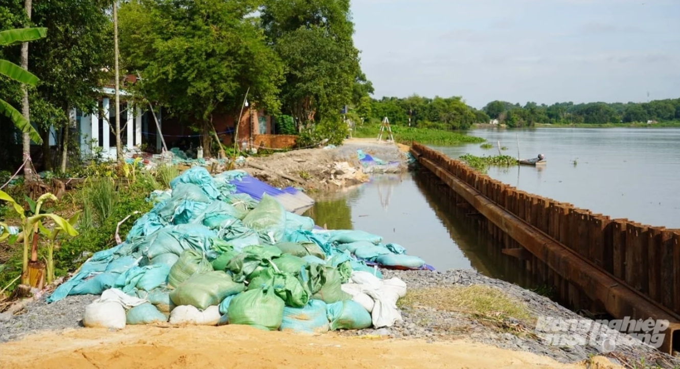 A landslide along the left bank of the Sai Gon River in mid-2025 affected many households. Photo: Le Binh.
In many parts of southern Viet Nam, unseasonal rains took farmers by surprise, damaging salt fields as well as vegetables that were close to harvest.
Even in the rainy season, intense local downpours were recorded. On May 10, 2025, Cu Chi station recorded 230.4 mm of rain, the highest of the year, underscoring how climate change is making weather harder to predict.
For agriculture and aquaculture, unusual weather brings risks. Unseasonal rain can quickly change salinity and water temperature, causing stress for farmed shrimp. Prolonged heat raises pond temperatures, reduces oxygen and increases the risk of disease.
Weather patterns likely to remain unpredictable
Looking ahead to 2026, experts expect weather patterns to remain unstable.
According to the Southern Regional Hydrometeorological Centre, ENSO is now in a weak La Niña phase, though its influence is fading. In simple terms, La Niña is weakening and affecting the weather less. From March to May 2026, ENSO is expected to move to neutral conditions, before possibly shifting to a weak El Niño later in the year.
Mr. Tran Van Hung, Deputy Director of the Southern Regional Hydrometeorological Centre, said this transition could make weather patterns more complex in 2026.
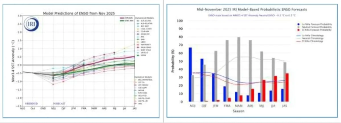 ENSO developments in 2025 and outlook for 2026. Photo: Southern Regional Hydrometeorological Centre.
Mr. Hung said heatwaves in 2026 are expected to be more intense than in 2025 and above average. They may start in early March and peak in early May, with temperatures reaching 37-38°C in the southeastern region.
“The rainy season in 2026 is likely to begin between late April and early May, close to the long-term average. However, total rainfall may be at or slightly below average. In the East Sea, around 12 to 14 storms and tropical depressions are expected, with four to five likely to directly affect Viet Nam. Thunderstorms, whirlwinds and lightning are also expected to become more frequent during the rainy season, especially in June, September and October”, he said.
Hydrological conditions also need close monitoring, as water levels in the Sai Gon-Dong Nai river system in 2026 are expected to be higher than average. Peak tides could reach 1.70-1.80 metres, around 0.10-0.20 metres above Alert Level III.
Mr. Hung said that as weather becomes more extreme, timely forecasts and warnings are essential. “Forecasts and warnings need to be delivered quickly so that local authorities can operate reservoirs, prevent flooding, drought and saltwater intrusion, and help people adjust their production plans,” he added.