Recognised by the World Meteorological Organization, five Vietnamese weather and hydrological stations have recorded over a century of climate data, a living archive connecting generations of scientists in understanding and forecasting the planet’s changing climate.
These include the Son Tay Hydrological Station (established in 1902), Cao Bang Meteorological Station (1879), Phu Lien Meteorological Station (1906), Chau Doc Hydrological Station (1909), and Hanoi Hydrological Station (1902). The recognition not only highlights their historical legacy but also underscores Vietnam’s scientific value and vital role in the global climate observation network.
Living milestones of Vietnam’s meteorological history
According to WMO standards, stations must demonstrate over 100 years of uninterrupted data collection, with consistent location, altitude, coordinates, and data quality to qualify for this distinction. Such criteria are stringent, as only long-term, uniform datasets enable scientists to analyse climate trends, detect changes, and verify forecast models.
Vietnam is among the few Southeast Asian countries with as many as five meteorological and hydrological stations meeting WMO’s century-old criteria. Each represents a distinct geographical and climatic profile, from northern mountains to midlands and deltas, including the Mekong Delta.
This recognition is a tribute to generations of Vietnamese meteorologists whose dedication has ensured the continuity of millions of recorded observations. These century-long datasets have become an invaluable scientific asset for climate research, disaster management, and sustainable development planning.
In an era of accelerating climate change, these “centenarian stations” serve as irreplaceable data anchors, supporting the calibration of climate models, disaster risk mapping, flood-control design, and national adaptation strategies.
As Vietnam’s meteorological sector advances toward modernization, with automated observation systems, artificial intelligence in data processing, and expanded remote-sensing networks, these century-old stations remain the scientific “roots” of trust, symbolizing humanity’s long journey of understanding, predicting, and adapting to nature.
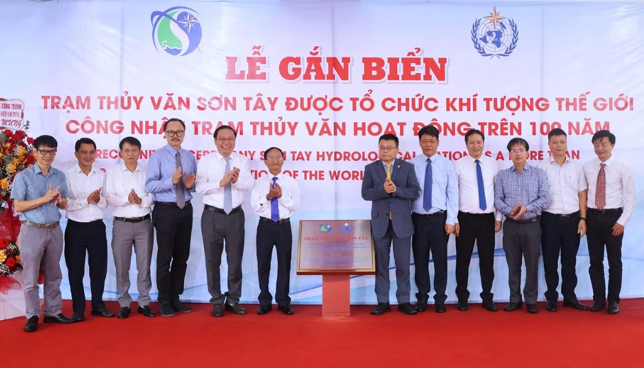 The ceremony marking the recognition of Son Tay Hydrological Station as a “Centennial Observing Station” by the World Meteorological Organization (WMO).
Son Tay Hydrological Station - The “companion” of the Red River
Founded in 1902, the Son Tay Hydrological Station sits along the Red River, serving as a crucial node in northern Vietnam’s hydrological observation network. Over more than a century, it has chronicled the river’s every transformation, from fierce floods to rare droughts.
Its century-spanning water-level and discharge records form the backbone of flood-prevention, irrigation, and disaster-warning studies for the Red River Delta. While modernized with automatic measuring systems, Son Tay continues manual monitoring to ensure data consistency across generations.
Cao Bang Meteorological Station - Where the northeast monsoon begins
Established in 1879, Cao Bang is one of the oldest meteorological stations in Indochina. Nestled in the northern highlands near the border, it records the region’s distinctive climatic features shaped by the northeast monsoon, frost, snow, and rare extreme weather.
Its long-term data have helped scientists better understand temperature, humidity, and rainfall patterns in high-altitude areas, significantly improving weather forecasting across northern Vietnam.
Phu Lien Meteorological Station - A weather observatory atop Hai Phong hill
Built in 1906 on a 100-meter-high hill in Hai Phong, Phu Lien once served as a leading meteorological, geomagnetic, and astronomical research hub during the French colonial period.
Despite wars and natural disasters, the station has remained active, preserving thousands of handwritten observation logs and early 20th-century instruments. Its colonial-style building is now a scientific heritage site, evoking the origins of Vietnam’s meteorological science. In 2019, WMO officially certified Phu Lien as a “Centennial Observing Station”, honoring generations of meteorologists who have “measured rain and counted wind” atop the hill.
Chau Doc Hydrological Station - The data flow of the Mekong Delta
Located on the Hau River in An Giang Province, the Chau Doc Hydrological Station began operating in 1909 and remains one of the key monitoring points in the southern hydrological network. Its data help track water levels, flow rates, flooding, and salinity intrusion across the Mekong Delta.
Amid intensifying climate challenges, Chau Doc’s role is increasingly vital, from flood forecasting and dike regulation to agricultural planning for sea-level rise adaptation. For more than a century, this “old water station” has measured the river daily, safeguarding the delta’s precious hydrological records.
Hanoi Hydrological Station - The capital’s weather diary
Established in 1902, the Hanoi Hydrological Station documents the capital’s climatic history, from the early 20th-century floods to recent record heatwaves. Its measurements of rainfall, temperature, and water levels reflect the city’s evolution and urban expansion.
With over 120 years of operation, the station’s dataset continues to inform infrastructure design, urban drainage planning, and research on the urban heat-island effect, serving as the living “climate diary” of Vietnam’s capital.